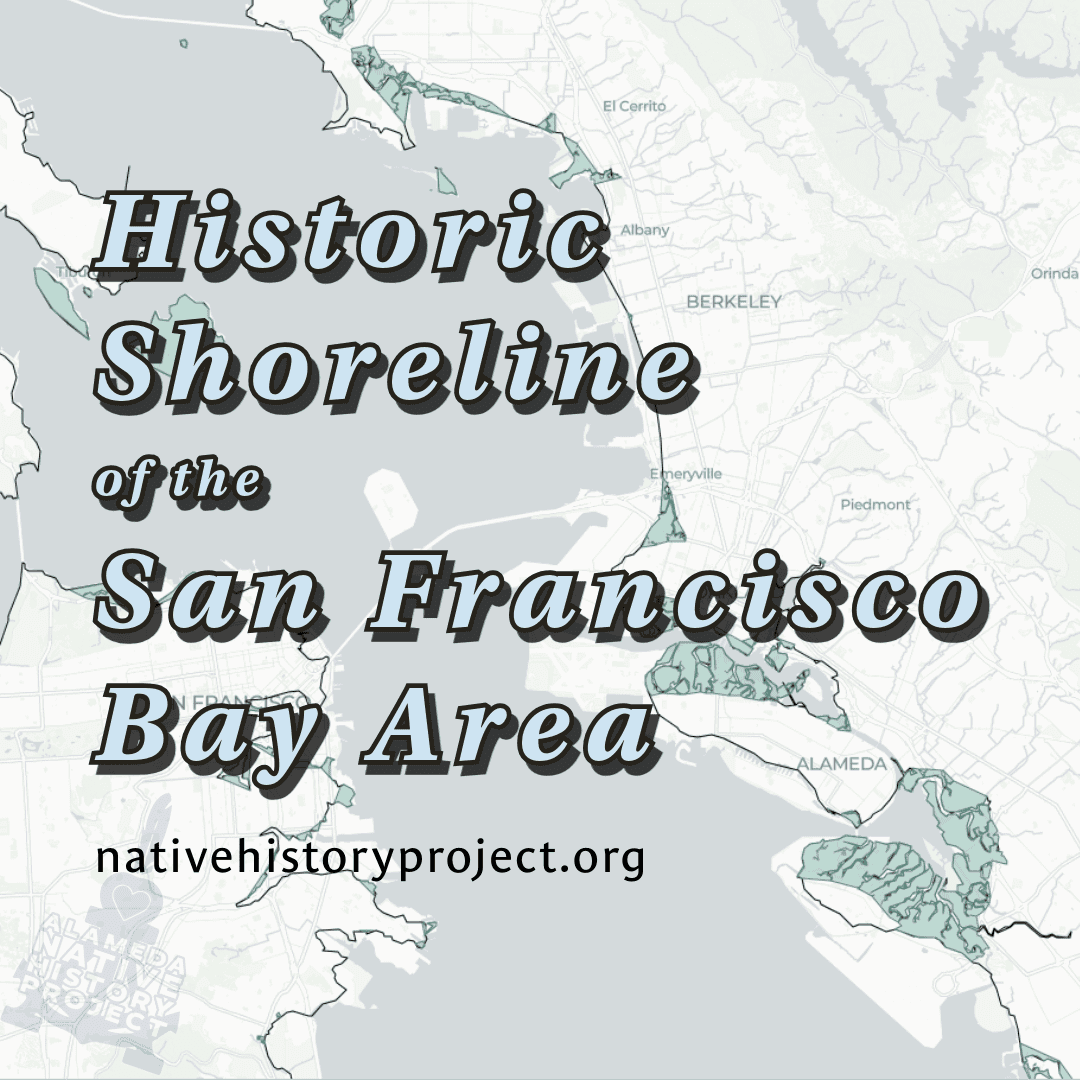
This is big. For the first time ever, the entire San Francisco Bay Area shoreline has been reconstructed and shared as a public, interactive, open-access map.
Historic Shoreline of the San Francisco Bay Area shows what the Bay once looked like, its original coastlines and wetlands before 1900, in a way no one has seen before. This is not just another overlay on top of modern maps. It is a full digital reconstruction that lets you see exactly where the old Bay met the land, and how much we have changed it.
This project was handmade by myself, Gabriel Duncan, Paiute, Two-Spirit, and member of the Open Source Geospatial Foundation, as part of the Alameda Native History Project GIS Lab. It was built using open data, open-source software, and a lot of patience. I stitched together historic shoreline datasets from NOAA’s National Geodetic Survey (NGS), the same data used to update nautical charts and define the nation’s territorial boundaries, to bring the Bay’s past back into focus.
Each section of shoreline was aligned, corrected, and merged into a single, continuous dataset covering the entire Bay. I colored the wetland areas by hand, guided by original survey markings, to give a sense of the marshes and tidal zones that once surrounded the Bay.
Like all historical maps, there are limitations. The data comes from surveys done more than a century ago using methods that predate modern GIS and satellite imagery. Small distortions and projection differences are expected. But that is part of what makes it powerful. This map connects us to a moment in time when the Bay was still alive in ways most people have never seen.
This work represents Native innovation in STEM and the continuation of Indigenous relationships with land, water, and technology. It stands as proof that Indigenous people are not just caretakers of the past but builders of the future, mapping, coding, and visualizing our histories through the tools of today.
The Historic Shoreline of the San Francisco Bay Area is available now. You can use it freely for noncommercial educational, environmental, and research purposes.
The dataset itself is reserved for Indigenous researchers and organizations.
This map joins the Bay Area Shellmounds Map, the Historic Alameda Ecology Map, and other original GIS projects in our Indigenous mapping initiative. Together they form a living record of place, memory, and truth, created by Native hands for everyone to see.